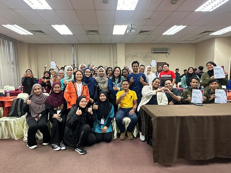
In an era where accurate geospatial data is vital to decision-making across sectors, training the next generation of professionals in advanced mapping technologies is more important than ever. A few months ago, Prestige Geomatic Resources (PGR) had the honor of co-organizing an impactful and enriching training event alongside Universiti Malaysia Kelantan (UMK) — the LiDAR Data Acquisition and Processing Course for Industrial Applications, held at the UMK Jeli Campus on 24–25 November 2024.
📚 Day 1 – Seminar Session: Theoretical Knowledge and Industry Insights
The first day kicked off with an inspiring lineup of experienced speakers from leading geospatial organizations, including GPS Land (M) Sdn Bhd, GMT Group, and Prestige Geomatic Resources. The sessions were designed to offer participants a comprehensive understanding of LiDAR fundamentals and applications across different sectors.
Key Topics Covered:
Introduction to LiDAR Technology
Presented by En Ahmad Thaariq Mohd Khairudin (GPS Land), this session laid the groundwork by exploring the fundamentals of LiDAR systems, types of LiDAR sensors, and their growing relevance across industries.LiDAR Data Acquisition and Processing
Delivered by En Mohd Juraidy Ahmad (Prestige Geomatic Resources), this session dove deep into real-world workflows, from flight planning to data post-processing, and emphasized data accuracy and efficiency.LiDAR for Geohazard Mapping
P.Geol Mohamad Faruq Syahmi (GMT Group) captivated the audience with compelling case studies on how LiDAR is being used to assess landslides, floods, and erosion-prone zones, enabling proactive disaster management.LiDAR in Topographic Mapping
The day concluded with En Ahmad Hanif Ahmad Termizi (GPS Land) showcasing how LiDAR is revolutionizing the way topographic maps are generated—making them faster, more accurate, and cost-effective.
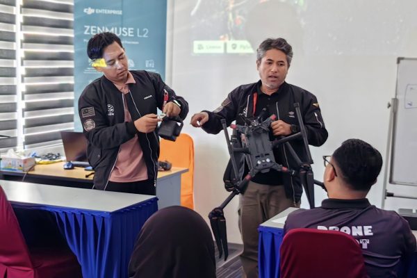
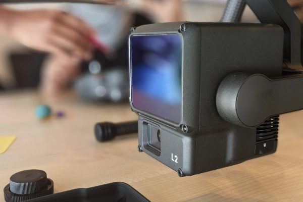
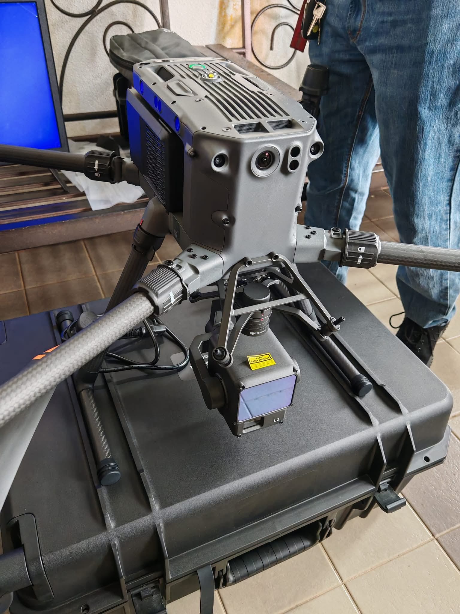
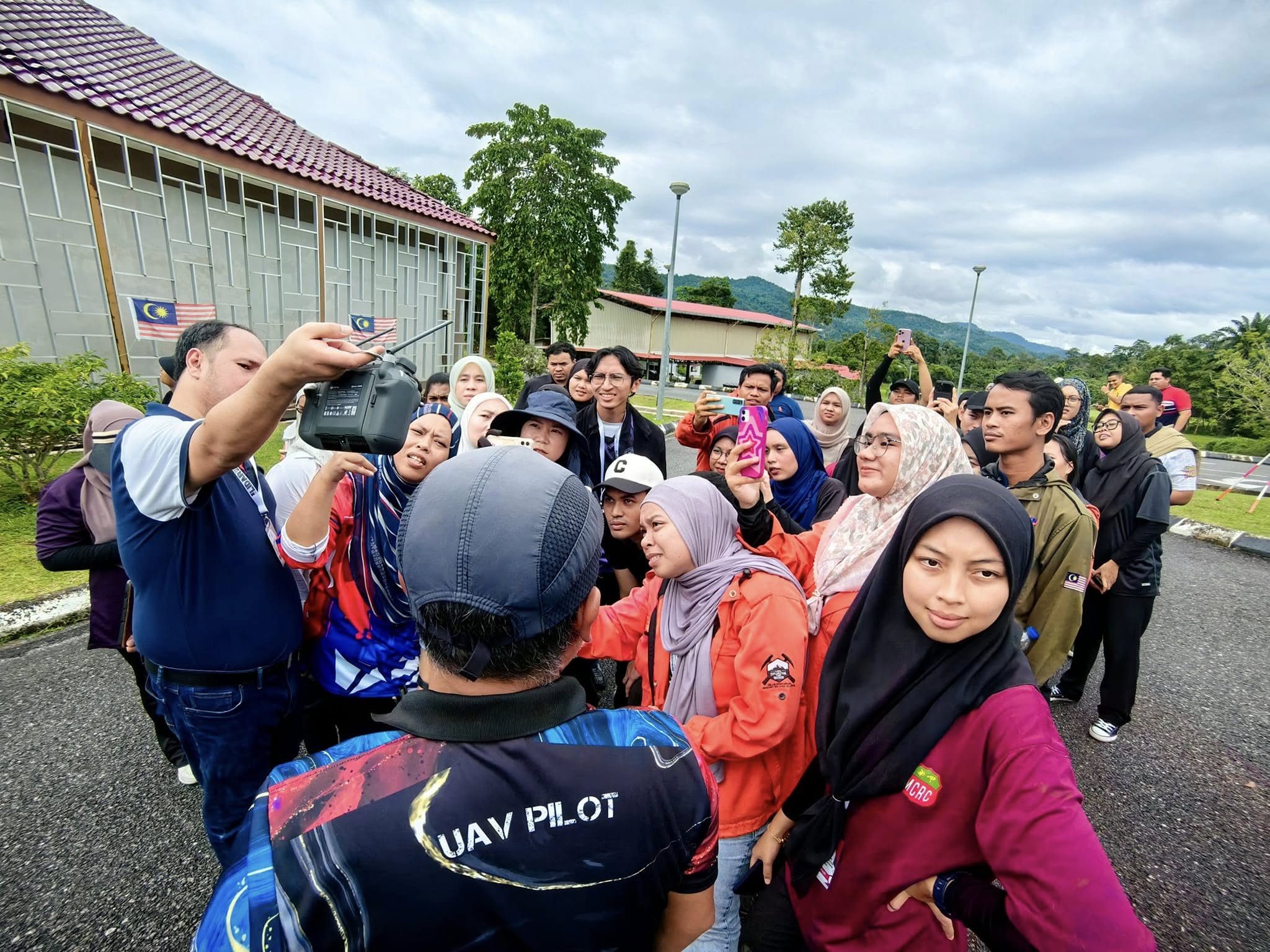
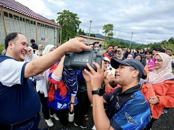
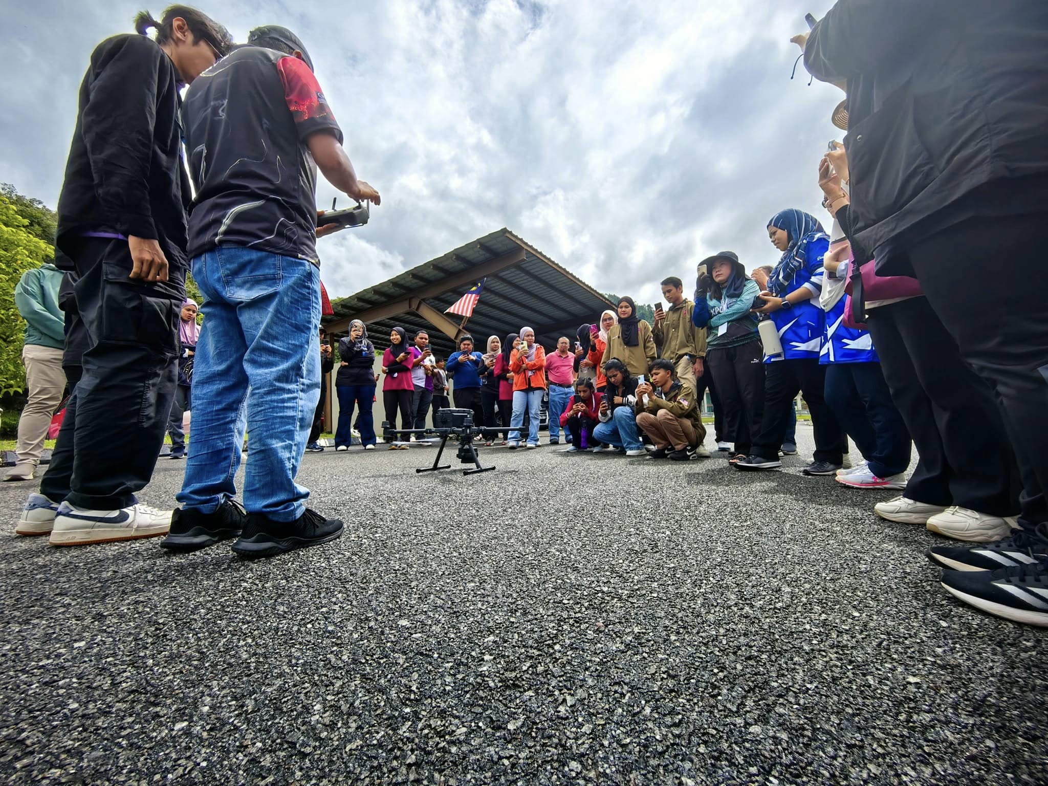
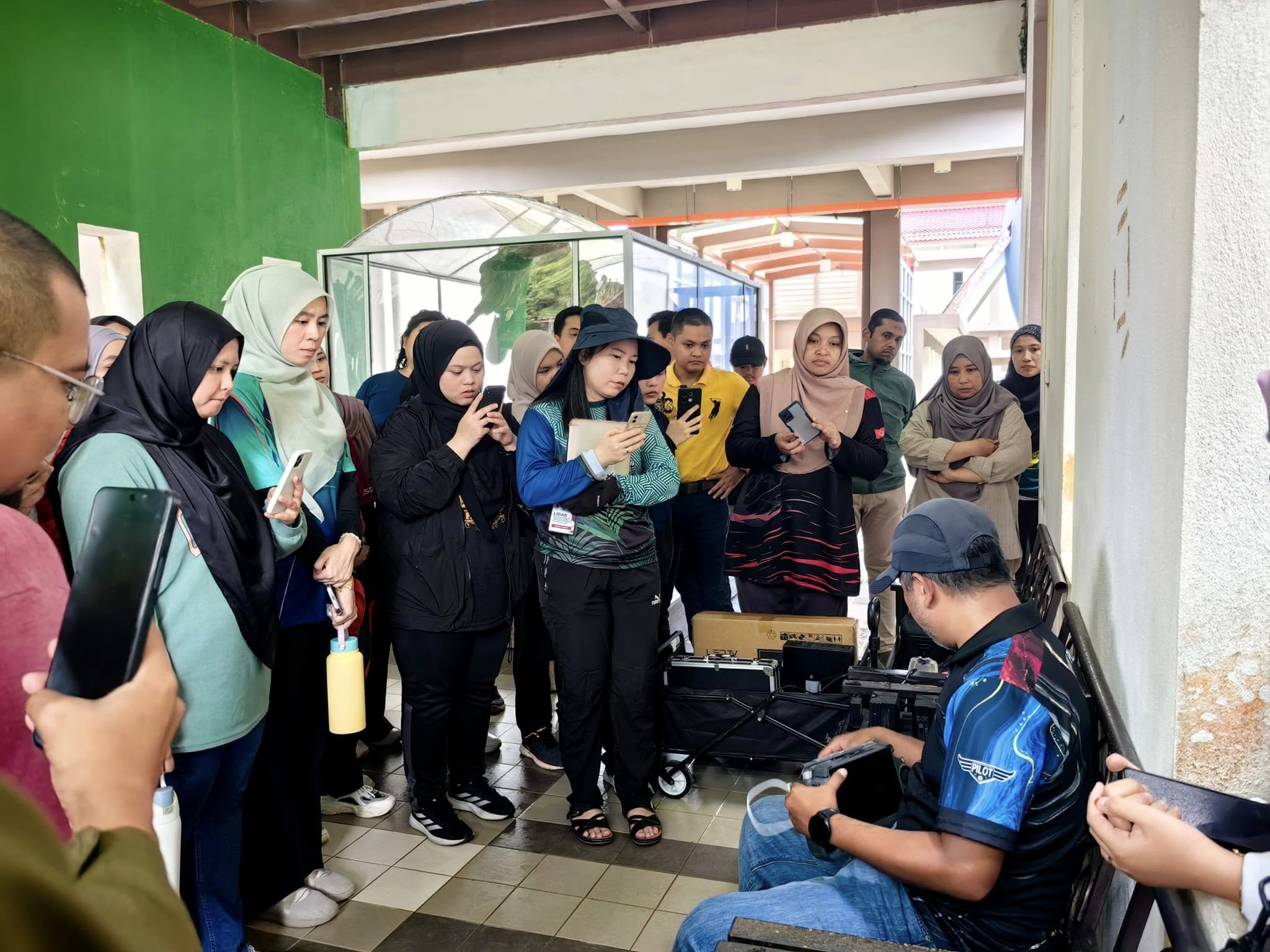
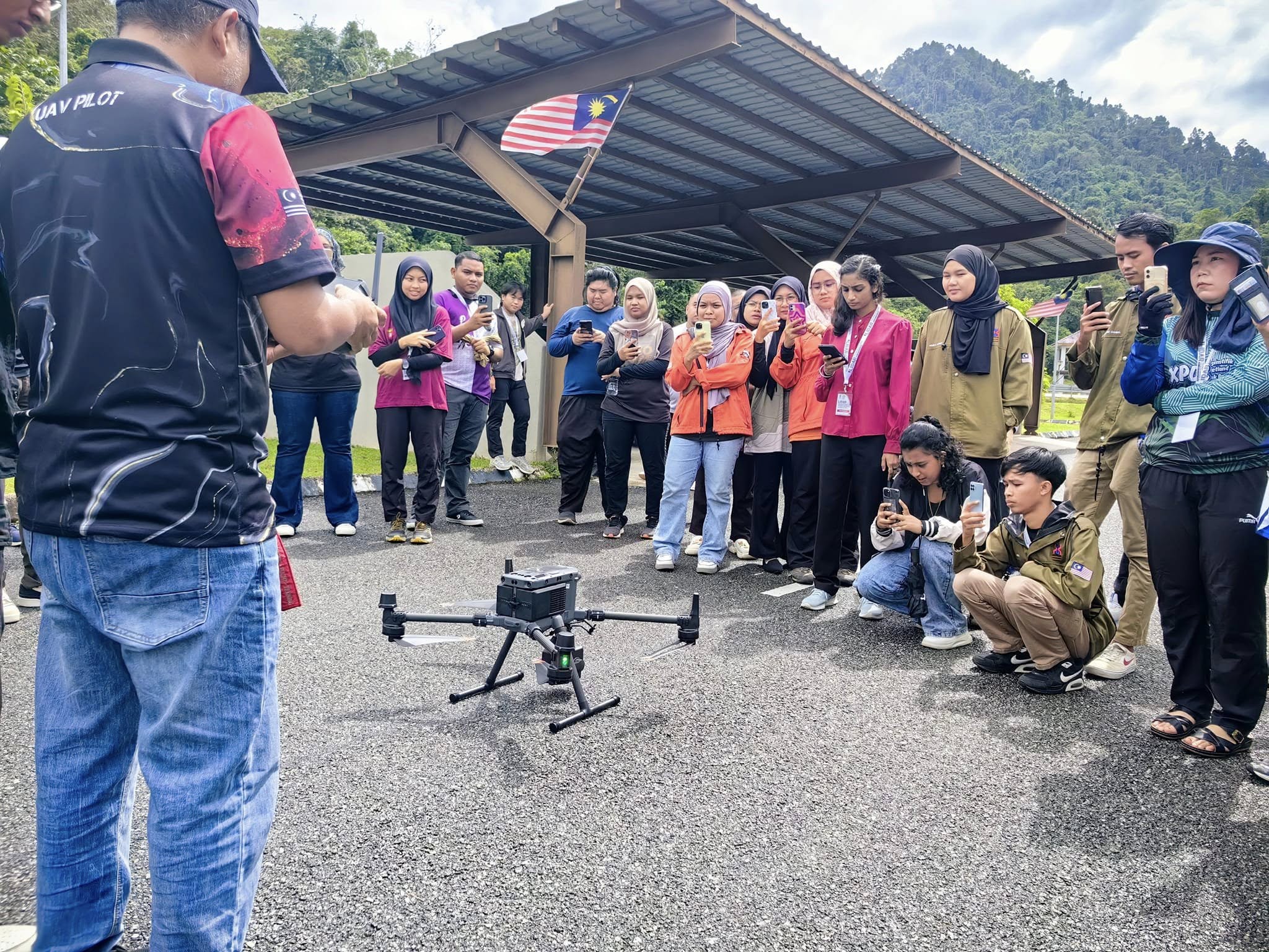
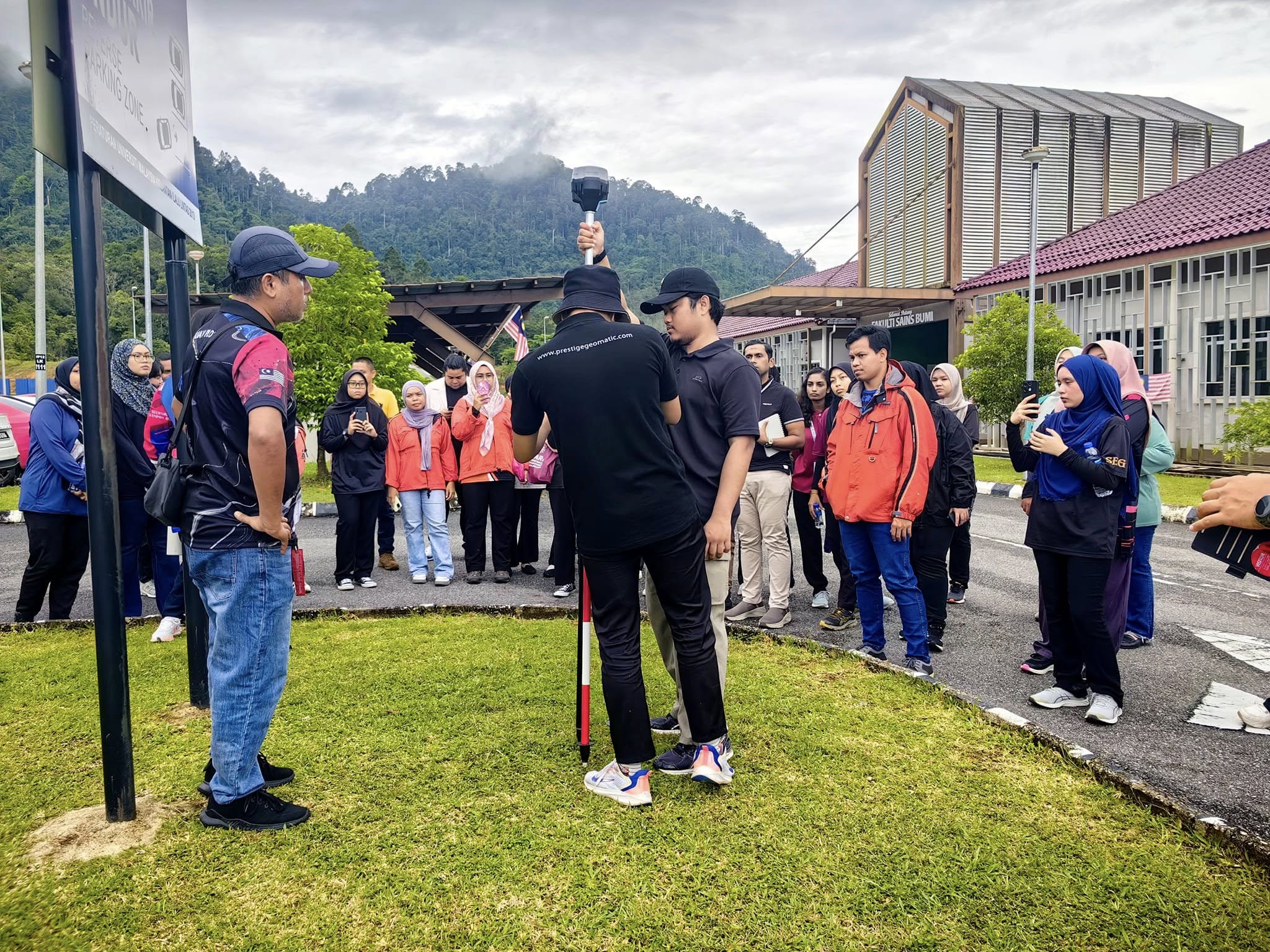
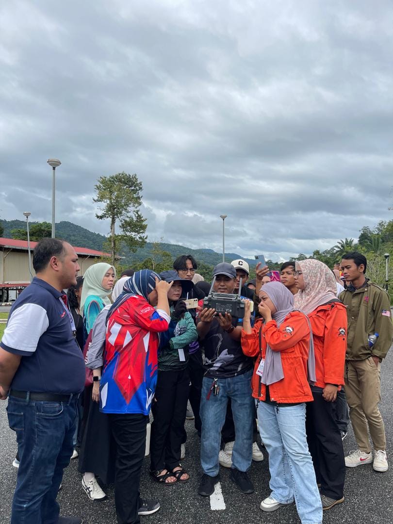
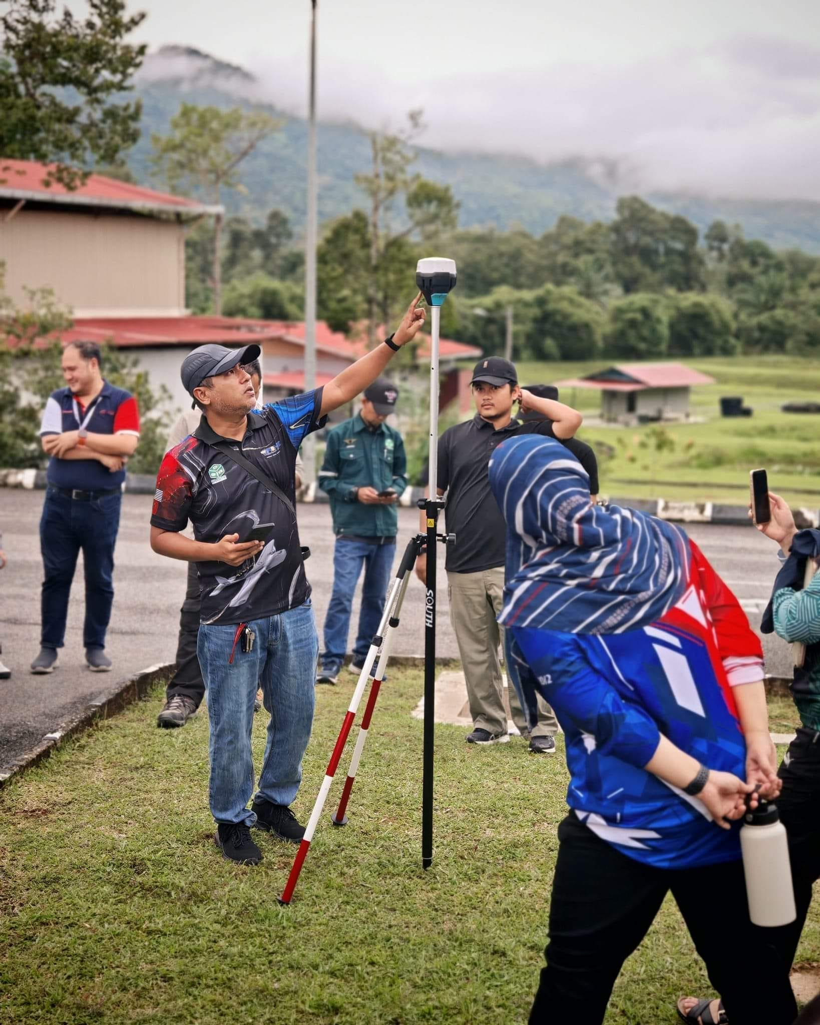
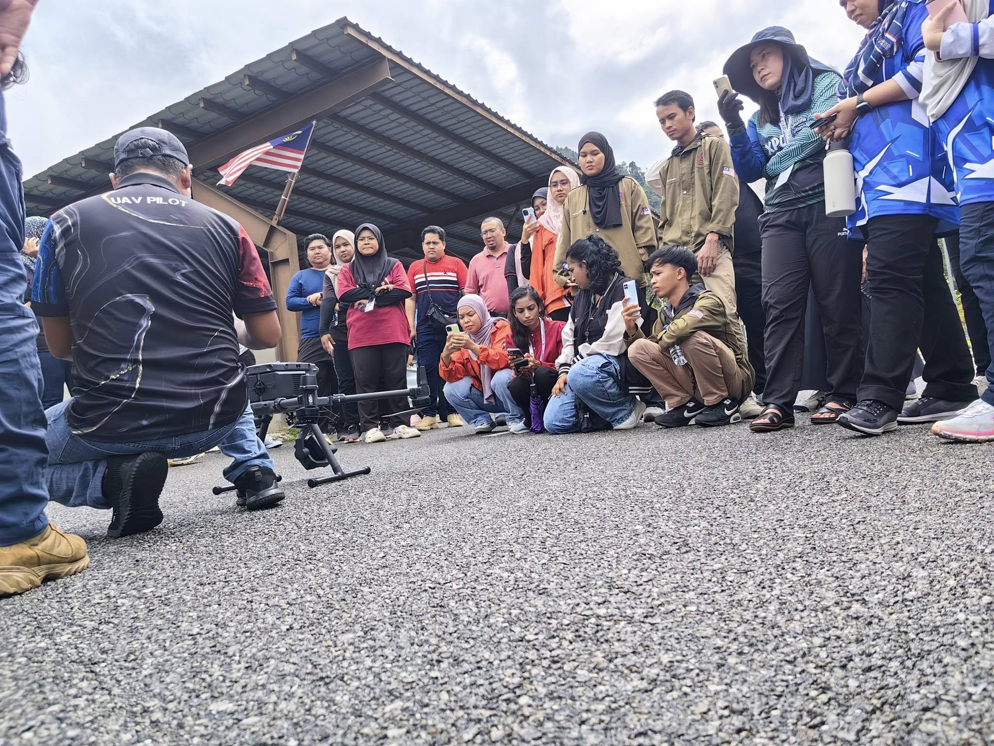
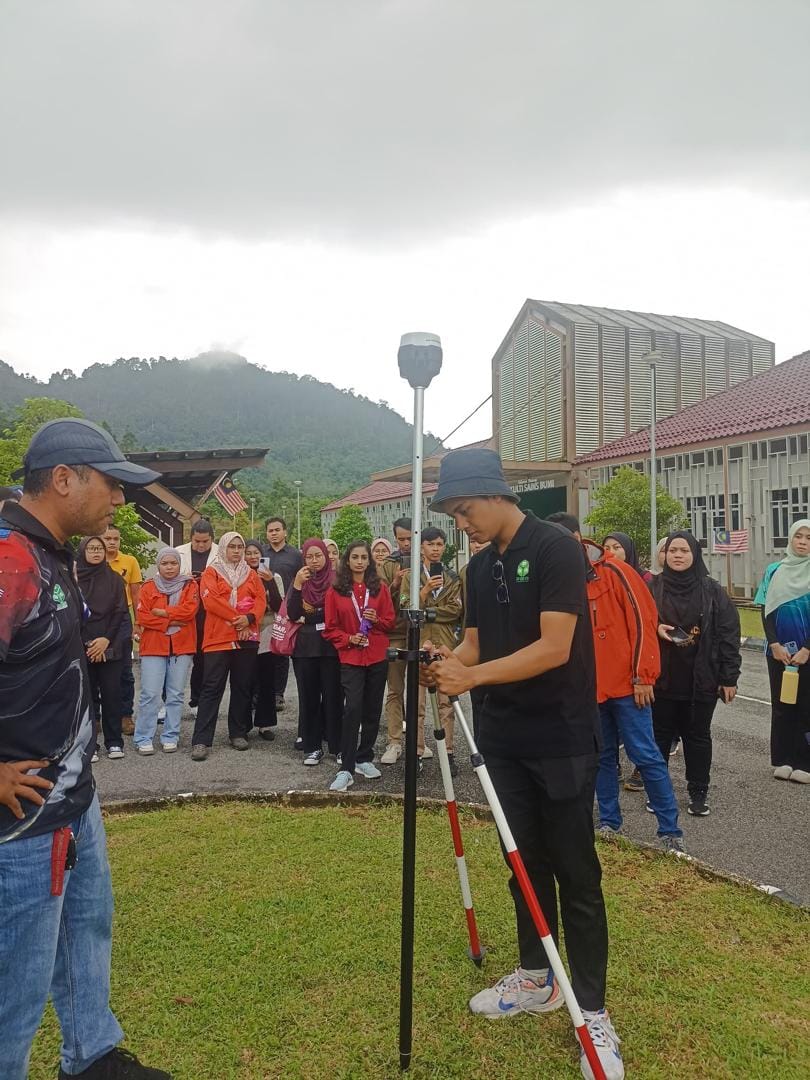
🛠️ Day 2 – Practical Session: Hands-on with Real Equipment
Theory came to life on the second day as participants were guided through live field data collection and processing exercises. This hands-on session enabled attendees to directly operate LiDAR equipment and gain practical exposure to:
Real-time data acquisition workflows using UAV-mounted LiDAR systems
Post-processing techniques using industry-standard software
Understanding ground control, calibration, and output validation
Interpreting point cloud data for different industrial scenarios
The training was led by our own En Mohd Juraidy Ahmad and P.Geol Mohamad Faruq Syahmi, both of whom emphasized data quality assurance, efficiency, and adaptability to different environments—especially in construction, infrastructure monitoring, and environmental analysis.
🎯 Impact & Outcomes
This course successfully achieved its goal of upskilling participants in the rapidly evolving field of LiDAR mapping. Many attendees shared that the blend of technical theory and hands-on practice was immensely valuable, particularly for those transitioning from conventional surveying methods to high-precision geospatial workflows.
Highlights: ✅ Strong turnout from both university students and professional participants
✅ Certified CPD (Continuing Professional Development) course
✅ HRD Corp claimable
✅ Networking and collaboration opportunities with industry experts
📣 Looking Ahead
At Prestige Geomatic Resources, we believe that knowledge-sharing and capacity building are key to advancing the geospatial industry in Malaysia and the ASEAN region. This successful collaboration with UMK is just one of many initiatives we aim to continue in the coming months—bringing LiDAR, photogrammetry, AI, and drone technologies to the forefront of industrial development and smart city planning.
📞 For partnership inquiries, upcoming training courses, or customized corporate workshops, reach out to us at:
📧 Email: info@prestigegeomatic.com
📱 Phone: +609-9477341
🌐 Website: www.prestigegeomatic.com
🔗 Follow us on social media for future announcements and technical insights!
#LiDARMapping #GeospatialTraining #UMKJeli #PrestigeGeomatic #IndustrialMapping #3DData #SmartSurveying #DroneLiDAR #CPDTraining #PGRxUMK #GeohazardMapping #TopographicMapping
